|
Lakes and Reservoir, see from the sky , with Google Earth |
|
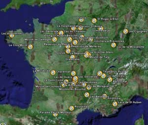
| Lakes
and reservoir in France: Google Earth
enable you have a satellite view of Earth, you can put Placemarks
to locate any place and return to it with a click.
We have build a map with almost all flyfishing lakes and reservoirs classified by region : Alsace, Auvergne.. To get it on your computer: |
 Larger picture |
|
Google Earth: The file is on the
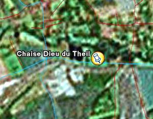
left "Places", 1) click on the left of the name (French lakes): open the "regions" name, 2) click on the left of one of the region : double click on the name of one of the lakes and your going to fly and zoom on the lake. An information window open. The links "To here" et "From here" do not in France. To do that go to http://www.viamichelin.com . To zoom in, click on + (below on the right of "Dining"), To zoom out click on - . You can go (North, South, East, West) with the 4 arrows. Click on "Roads" and the roads will show up. Some areas have a high definition, see on the left "le Réservoir de Charensat" i n Auvergne or below " la Salamandre" in Picardie .For others it is much les, nevertheless you still see the lake: see below La Chaise Dieu du Theil. |
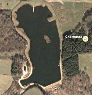 Charensat |
|
|
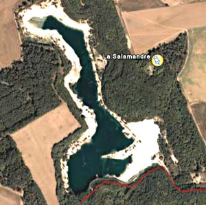 La Salamandre |
|
|
|
|
|
|
|
| |